
6 Model Geography and Years
Once a VisionEval model has been selected, the next step is deciding on the model geography and years. Both the model geography and years will inform the input data needed.
6.1 Years
Inputs in VisionEval are developed for every model year. Most applications consist of a base year and a future year. If the model area has a travel demand model available, it is good practice to align the VisionEval model years with those in the travel demand model, allowing the user to use the travel demand model to develop VisionEval inputs and validate the VisionEval Model. VisionEval may be used to model interim years, however each year modeled requires additional input data.
6.2 Geography
All VisionEval models share a standard geography framework. Although models are applied at different scales, sharing a common geographic definitions enables modules to be more readily shared between models. The standard geogrpahy framework specifies levels of geographical units, their names, their relative sizes, and the hierarchical relationships between them. It is flexible in that it allows geographical boundaries to be determined by the user and it allows the units in some geographical levels to be simulated rather than being tied to actual physical locations. Allowing simulation of one or more geographic levels enables modules to be shared between models that operate at different scales. For example a statewide model and a metropolitan area model could use the same module for assigning households to land development types even though the statewide model lacks the fine scale of geography of the metropolitan model.
Following is the definition of the geographic structure of the VisionEval model system:
- Region level is the entire model area. Large-scale characteristics that do not vary across the region are specified at the region level. For example, the carbon intensities of vehicle fuels are defined at the region level since they tend not to vary widely across a large geographic area. Typically, in a VERSPM model the region level is the metropolitan planning region being modeled, for VE-State it’s the entire state.
- Azones are large subdivisions of the region level. Azones are used to represent demographic and economic characteristics that vary across the region such as population forecasts of persons by age group and average per capita income. County boundaries are commonly used to represent Azones in both VE-State. In VERSPM, county or municipal boundaries are commonly used. The Azone level of geography must represent actual geographic areas and may not be simulated.
- Bzones are subdivisions of Azones. Bzones are nested within Azones and provide more granularity on the intensity and nature of development. Bzones may correspond to actual geographic areas or may be simulated. Bzone simulation greatly reduces model input data requirements while still enabling the modeling of land-use-related policies and the effects of land use on various aspects of travel behavior. In VERSPM, Bzones must be represented by actual geographic areas; examples of VERSPM Bzone inputs include housing and population density. Common Bzone boundaries for VERSPM are TAZs, Census Tracts, or Census Block Groups. In VE-State and VERPAT, Bzones are simulated and do not represent physical geographic boundaries. Bzones in VE-State are synthesized to represent characteristics likely to be found in an actual set of Bzones within each Azone, such as neighborhood density. In VERPAT, Bzones are simulated as place types which characterize the intensity and nature of development.
- Mareas represent metropolitan urbanized areas. Mareas are represented in VisionEval as collections of Azones associated with an urbanized area either because a portion of the urbanized area is located in the Azone or because a substantial proportion of the workers residing in the Azone work at jobs located in the urbanized area. Metropolitan models (VERSPM and VERPAT) typically only have one assigned Marea whereas state models may have several. The model system requires that each Azone may be associated with only one Marea. It is also required that all Azones be associated with an Marea. A special Marea named ‘None’ is used to apply to Azones that are not associated with any urbanized area. Mareas are used to specify and model urbanized area transportation characteristics such as overall transportation supply (transit, highways) and congestion. They are also used to specify large scale land-use-related characteristics and policies in models that use Bzone synthesis.
- Location Type is not a geography level but a categorical level that identifies whether households are urban/town/rural.
- Place Type is not a geography level but defines the level of urbanization (area type) and mixing of jobs and housing (development type).
6.2.1 Setting Up the Model Geography
Users should note that their selected model geography will determine the geography levels for input data development. Geographical relationships for a model are described in the “geo.csv” file contained in the “defs” directory. This file tabulates the names of each geographic unit (except for region) and the relationships between them. Each row shows a unique relationship. Where a unit of geography is not explicitly defined (i.e. it will be simulated), “NA” values are placed in the table.
The examples below show versions of the “geo.csv” file where only Azones are specified and where Azones and Bzones are specified. It should be noted that there are no naming conventions for individual zones. The user is free to choose what conventions they will use.
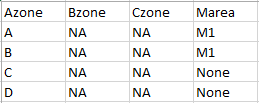
Example of a geo.csv file that only specifies Azones
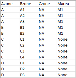
Example of geo.csv file that specifies Azones and Bzones
6.2.1.1 Model Geography Example
This section details the model geography for ODOT’s VE-State model as an example. The geography levels are defined as follows:
- Azones must be physical boundaries and are represented by counties.
-
Mareas are represented by the boundaries of Metropolitan Planning Organizations (MPOs), which can be multi-county. Azones, or counties, without an MPO have the Marea
None. -
Location Type (Urbanized, Town, Rural) are defined as MPOs being urbanized (defined in the model as
Metro), urban growth boundaries (UGBs) smaller than MPOs areTown, and the rest isRural. - Marea Area Types (Center, Inner, Outer, Fringe) (VE-State only) are based on VE-State EPA-SLD-based definition. ODOT builds TAZ-level place type maps for all MPOs to generate.
ODOT VE-State geo.csv
| Azone | Bzone | Czone | Marea |
|---|---|---|---|
| Baker | NA | NA | None |
| Benton | NA | NA | Corvallis |
| Clackamas | NA | NA | Metro |
| Clatsop | NA | NA | None |
| Columbia | NA | NA | None |
| Coos | NA | NA | None |
| Crook | NA | NA | None |
| Curry | NA | NA | None |
| Deschutes | NA | NA | Bend |
| Douglas | NA | NA | None |
| Gilliam | NA | NA | None |
| Grant | NA | NA | None |
| Harney | NA | NA | None |
| Hood River | NA | NA | None |
| Jackson | NA | NA | RogueValley |
| Jefferson | NA | NA | None |
| Josephine | NA | NA | GrantsPass |
| Klamath | NA | NA | None |
| Lake | NA | NA | None |
| Lane | NA | NA | EugeneSpringfield |
| Lincoln | NA | NA | None |
| Linn | NA | NA | Albany |
| Malheur | NA | NA | None |
| Marion | NA | NA | SalemKeizer |
| Morrow | NA | NA | None |
| Multnomah | NA | NA | Metro |
| Polk | NA | NA | SalemKeizer |
| Sherman | NA | NA | None |
| Tillamook | NA | NA | None |
| Umatilla | NA | NA | None |
| Union | NA | NA | None |
| Wallowa | NA | NA | None |
| Wasco | NA | NA | None |
| Washington | NA | NA | Metro |
| Wheeler | NA | NA | None |
| Yamhill | NA | NA | None |
Users can also have Mareas be equivalent to a Census urbanized area definition. Mareas do not include Town location types within the Marea counties. As such, “towns” in the Marea counties typically fall outside of the continuous urbanized area (i.e. Census urbanized area). A county with only Town and Rural location types will have the Marea None. Some exceptions may be made if the outside areas are contiguous enough with the official urbanized area or will be in the horizon of the modeled scenarios, such that they will use common (high frequency) transit systems, and share the same road/congestion. Some examples of this are Eugene VERSPM model including the city of Coburg as “urbanized” rather than a “town” and Portland including Ridgefield in the urbanized area. The recommendation can be summarized as designating an Marea city outside the census “Urbanized area” definition as “towns” unless: (1) they are contiguous to the larger urbanized area, or will be in the planning horizon, or (2) if they have significant transit service, road congestion that the “town” formulas will not account for.